

Farm Resilience

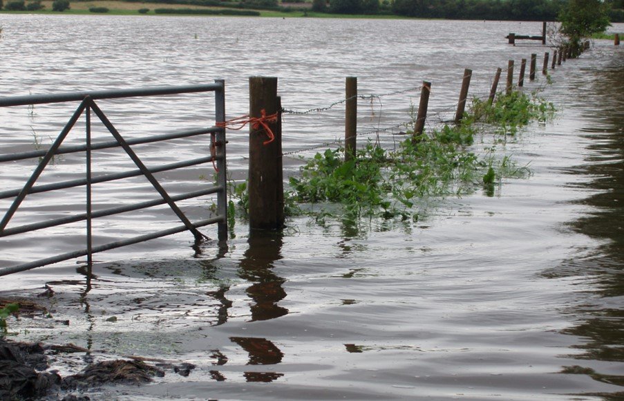
Farm Resilience: Introduction
This report provides a summary of European practices promoted or adopted by farmers and growers to strengthen resilience to flooding, drawing extensively on examples from the Netherlands, Flanders and Germany. It also highlights examples from England, and how the wider catchment benefits of all these approaches and their relevance to flood risk management and nature recovery.
Core principles of farmer-led flood resilience
Across all countries reviewed, a consistent set of principles emerges:
Improving the landscape's water holding capacity
Enhancing soil health and management
Reconnecting rivers to their floodplains
Integrating land management with water governance
Support for farmers with tools, incentives and tailored advice
These principles underpin the practices described throughout this report.
International Examples:
The Netherlands
The Netherlands demonstrates a whole-system approach to agricultural flood resilience. Area-specific bottlenecks are identified, enabling tailored measures including individual farm protection. Erosion-control measures are widely used, supported through mandatory requirements in high-risk areas and subsidies for non-productive investments. Large-scale initiatives such as Room for the River and the National Adaptation Strategy emphasise transformation of land use, river reconnection and nature-based solutions. Tools such as the Climate Stress Test and Waterwijzer Landbouw help farmers understand climate risks and link management measures to local hydrological conditions. The BOOT-list provides a set of good water and soil management practices, many of which qualify for financial support.
-
Actors: National Government, in cooperation with water authorities and provinces
Tool: Floodplain reconnection and bypasses
Goals: Create space for Rhine and Meuse rivers to pass flood water safely while improving landscape quality and nature; add resilience for periods of low water.
Role during floods: Move dikes (flood defences) back, lower floodplains, and add side channels to spread and speed safe conveyance, reduce peak water levels and load on defences, cutting breach risk.
Note: This programme has been a success, triggered by huge fluvial floods in 1995. A new programme ‘Room for the River 2” is at design phase, but unlikely to receive the same level of funding as the initial program.
-
Actors: National Government in cooperation with others, including the agricultural sector
Goal: Since January 2024, work has been undertaken to develop the National Adaptation Strategy 2026 (NAS’26). This is an important building block for the new climate scenarios and recent scientific reviews of climate risks. The NAS is a national strategy; it involves the collaboration of many government departments: Infrastructure and Water Management; Housing and Spatial Planning; Climate Policy and Green Growth; Economic Affairs; Justice and Security; Agriculture, Fisheries, Food Security and Nature; Education, Culture and Science; Social Affairs and Employment; Health, Welfare and Sport. Other parties involved include research institutes and the umbrella organisations: the Association of Netherlands Municipalities (VNG), the Association of Provincial Authorities (IPO) and Dutch Water Authorities (UvW).
Notes:
Lack of definition and urgency (slow implementation)
Too abstract – the NAS'16 (the 2016 strategy) was criticised for setting too few clear goals, leaving the policy non-binding.
Acceleration needed – assessments show that climate change is occurring faster than expected, necessitating accelerated implementation of the current strategy.
Reactive instead of proactive – in many programs, the analysis of climate risks is superficial, leading to a reactive approach instead of structural, preventive measures.
Financial and social uncertainty
Lack of resources – the lack of sufficient financial resources for large-scale adaptations is seen as an obstacle.
Cost allocation – it is often unclear who bears the costs of climate adaptation (government, citizens, or businesses). There is a call for a clear 'climate damage ladder'.
Policy and Administrative Bottlenecks
Conflicting interests – climate adaptation often clashes with other interests, such as housing construction and intensive agriculture, leading to slow decision-making.
Fragmentation – fragmentation exists within and between levels of government (municipalities, provinces, water boards), making an integrated approach difficult.
Insufficient involvement of vulnerable groups – criticism focuses on the fact that vulnerable groups in society are not sufficiently reached and participation is low.
Need for 'Transformation' (NAS'26)
Intensification is not enough - the Scientific Climate Council (WKR) advised that 'intensification' alone (preserving existing functions with additional measures) is insufficient.
Modification – the Scientific Climate Council have suggested the focus should be on 'transformation' (change of function and land use, such as building housing in locations that are compatible with water and soil conditions).
Evaluation and Review
A new NAS in 2026 – due to criticism of its slowness and the worsening climate scenarios, the Ministry of Infrastructure and Water Management is working on an update to the NAS'26.
Scientific Climate Council recommendation – the Scientific Climate Council emphasised that the new strategy should focus more on disclosing climate risks for homes and protecting vulnerable people.
The majority of the criticism focuses not so much on the purpose of the NAS, but on the lack of action, unclear cost allocation, and the need for a more radical, transformative approach to spatial planning in the Netherlands.
-
Actors: National Government in cooperation with many others
Goals: The Action Programme for Climate Adaptation in Agriculture describes how the agricultural sector can prepare for extreme weather and other risks associated with climate change. To do this, the sector needs help from other parties, like water authorities.
Notes:
The 5 pillars of the Action Programme for Climate Adaptation in Agriculture are:
Water system – a good water system helps farmers manage drought or flooding. Together, water authorities, nature site managers and farmers need to work on improving water retention in nature reserves and on farmland, to minimise the damage to plants and animals during a prolonged drought.
Soil system – healthy soils can take up, store and deliver water and nutrients to plants. This is essential for good crop yields, and it is even more important in a changing climate. It also helps if farmers plough less often, use lighter machinery and grow crops with more extensive root systems.
Crops and cultivation systems – extreme weather, like heatwaves, heavy rainfall, hailstorms or frost, can damage plants and crops. A changing climate can also create favourable conditions for new pests and diseases. Farmers and growers can take measures to protect their crops. For instance, they can choose varieties that are more resilient against extreme weather or grow fruit under cover.
Livestock farming – heat and drought are very stressful for livestock animals like cows, pigs and poultry. Climate change may result in new pests or animal diseases. Good ventilation and cooling systems in livestock sheds help keep animals comfortable and access to shade for livestock outdoors. There are also rules for the transportation of livestock during a heat wave to safeguard animal welfare.
Support – the Netherlands has many different types of landscape, such as sandy soils, coastal dunes, riverscapes, and peatland pastures. Climate change poses different problems for each type of landscape. These problems are tackled at local level in close collaboration between water authorities, municipal and provincial authorities and farmers.
A lot of research has been undertaken to assess the ways the agricultural sector can adapt to a changing climate. An adaptation action programme was drafted by the Ministry of Agriculture, Nature and Food Quality, with input from the Netherlands Agricultural and Horticultural Association (LTO), the Ministry of Infrastructure and Water Management, the Dutch Water Authorities, the Association of Provincial Authorities (IPO), the Association of Netherlands Municipalities (VNG), and the Dutch Association of Insurers.
-
Actors: Farmers, agricultural university (Wageningen)
Notes:
Wageningen University & Research (WUR) has developed a Climate Stress Test for open field cultivation: a practical tool that helps arable farmers, advisors, and other stakeholders to understand and discuss climate risks at the farm level. Drought, flooding, and increasing pressure from diseases and pests are increasingly impacting agricultural yields, according to WUR at the launch.
The Climate Stress Test combines climate data from the Royal Netherlands Meteorological Institute (KNMI), model calculations from the Waterwijzer Landbouw (Water Guide for Agriculture), and expert assessments of diseases and pests.
By entering postal code, crops, and acreage, the tool shows what climate change could mean for the yield and financial risk of a specific farm. This is expressed in euros per hectare and yield change per crop. The tool distinguishes between various climate factors, such as drought, wet conditions, soil workability, and diseases and pests.
The Climate Stress Test is intended as a discussion tool. The results act as a starting point for further conversation between farmers and advisors about climate adaptation and WUR noticed that starting the conversation about climate adaptation can be challenging. Farmers are often focused upon day-to-day activities, which means shifting their focus to the long term, requires extra effort. Potential measures are also linked to the results. This provides practical information about adjustments in soil, water, and crop management, including the pros and cons and their practical applicability.
The tool was developed in close collaboration with farmers, advisors, educational institutions, financial institutions, and advocacy organizations. The researchers emphasised that the results of the Climate Stress Test are guidance. As climate risks can be variable and depend on local circumstances, the tool doesn't offer precise predictions, but it helps users better understand risks and make informed choices for the future. The Climate Stress Test is available free of charge at www.klimaatstresstest.nl.
-
Actors: Farmers, supported by national and local government, water authorities, Environment Agency equivalents, local councils, and Internal Drainage Boards (IDBs)
Tool: Raised dwelling mounds (“terpen”) for farmsteads within active floodplains
Goals:
Enable farmland to be returned to active floodplain while maintaining viable agricultural operations
Protect critical farm assets (homes, livestock, machinery, stores) from flooding
Increase long-term climate resilience in lowland agricultural systems
Shift perception of flooding from “disaster” to “manageable event”
Role during floods:
Farm buildings are elevated on artificial mounds above expected extreme flood levels, ensuring they remain dry even during severe events
Surrounding land is allowed to flood naturally, reducing pressure on flood defences and accommodating floodwater storage
Agricultural losses are largely limited to temporary crop damage, while core assets and livelihoods remain protected
By separating “floodable” land from “non-floodable” assets, the system reduces overall flood risk and speeds post-flood recovery
Notes:
Terpen are a historic Dutch adaptation measure dating back more than 2,000 years, now being revived as part of modern climate resilience strategies
The approach aligns with “living with water” principles, recognising floods as temporary and manageable rather than catastrophic
Recent projects in the Netherlands demonstrate how traditional practices can be integrated into contemporary floodplain restoration schemes, combining heritage with innovation
The concept supports wider floodplain reconnection programmes by making it feasible for farms to operate within areas designed to flood
Implementation requires appropriate regulatory approvals and coordination with environmental and planning authorities
While highly effective for resilience, such measures can involve significant upfront investment and site-specific design, meaning they may sit outside standard guidance or funding frameworks
The approach highlights a broader transition toward adaptive land use, where human activity is redesigned to work with natural water systems rather than resist them
-
Actors: Farmers.
Goals: To compile a list of useful measures that farmers can undertake for good water and soil management. Measures are eligible for subsidies (by waterboards, provinces). The ‘BOOT-list’ gives legitimacy (for subsidies) to the boards.
Notes:
Farm Management
Switches to a fully grass-fed farm
Develop a broader cropping plan with break crops, and rotations that exceed those required by the 7th Environment Action Programme (Nitrate Directive)
Use a tool to gain insight into nutrient and pesticide emissions
Implement measures to combat nutrient and pesticide emissions
Promote cooperation on land use rotation to prevent soil depletion and/or improve soil structure
Develop an area-specific plan focused on soil and water management
Develop a wetland crop management plan
Use decision support systems for irrigation, fertiliser application, and crop protection
Employ extensive grazing (maximum 1.5 livestock units per hectare).
Develops a fertiliser plan
Develop a soil passport
Employ agroforestry in farm management: plants trees and shrubs on plots with arable crops or grassland
Employ circular agriculture: minimise unnecessary use and losses of nutrients, minerals, energy, water, raw materials, and crop protection. Practice good soil management and the reuses of waste products.
Participate in knowledge exchange programs, study groups, or thematic meetings
Soil Improvement
Use fixed tramlines on the plot using GPS
Construct terraced areas
Apply drag hose (umbilical) fertiliser methods (preferably with low tire pressure)
Use no-inversion tillage or eco-plough with mechanical tillage if necessary
Prevent rutting due to low tire pressure, uses lighter machinery, and/or by not tilling the soil in wet conditions
Till the soil perpendicular to the slope
Use a combination of shallow and deep rooting grass species
Use a combination of shallow and deep rooting (dormant) crops
Level out depressions in plots (to remove wet areas)
Establish organic matter balances and, if necessary, add compost or other sources that increase soil organic matter
Convert grassland into productive, species-rich grassland
Improve soil structure by applying soil improvers
Crop Protection Products
Use a washing area with a purification system
Use an emission-free box cleaner and/or a leak-proof bulb cart
Choose a variety of crops and varieties that are more resistant to diseases and pests
Use crop protection products with a low risk profile, if possible, of natural origin
Use non-chemical soil disinfection, for example, through flooding or the cultivation of marigolds
Use biological and/or natural pest control, with special attention to strip cropping, (flowery) field margins, and green manures to prevent nematodes and soil-borne diseases and pests
Use mechanical or non-chemical (weed) control
Work the green manure and/or turf mechanically and incorporate it mechanically instead of spraying it to kill it
Use a closed system for filling, dosing, and internal cleaning of spray equipment and packaging
Use sensor controlled or other selective and targeted spray equipment
Use spraying techniques with higher drift reduction than legally required
Maintain a wider cultivation free zone along surface water than legally prescribed
Land Management
Optimise grazing
Maximise the proportion of permanent grassland
Grow crops to reduce phosphate on fields with a high phosphate status
Improve grass cover by reducing the mowing and/or grazing length from 5 to 7 cm.
Grow early maturing crops and sows a nitrogen catch crop immediately after harvest (or under sown maize)
Apply green manures
Prevent fallow land in winter
Use mixed cropping
Do not grow leaching prone crops on leaching prone soils to reduce the risk to groundwater
Do not grow maize (but rather grass, for example) on wet soils (GWT 75%)
-
Actors: Farmers, Insurers, EU (funding via CAP), RVO (which is the Dutch equivalent of the Rural Payments Agency)
Goals: The Comprehensive Weather Insurance offers agricultural businesses protection against weather damage (hail, storms, drought, frost, rain) to open-field crops, with a government subsidised premium of up to 63.7%. Applications for the subsidy can be submitted from 1 March to 15 May 2026 to the Combined Declaration at RVO.nl. A total of €17.5 million in subsidies is available in 2026. A ceiling has been set for the subsidy; if the ceiling is exceeded, a pro-rata deduction will be made. The policy covers damage caused by extreme weather conditions, including hail, storms, heavy rainfall, drought, frost, snow, sleet, and fire caused by lightning. This insurance is offered by recognised companies, such as Vereinigte Hagel (with Secufarm and Agriver). Policy approval by the insurer is required, often with a deadline before December 1, 2025.
Notes:
The comprehensive weather insurance in Dutch agriculture is intended to cover crop damage caused by extreme weather (hail, drought, frost, rain) but has received considerable criticism. Despite government support through premium subsidies, participation is low (only about 1 in 10 arable farmers is insured).
The main points of criticism are:
High costs (premium): Despite the government subsidising more than 60% of the premium, many farmers still find the insurance too expensive. The deductible is often substantial, making it financially unattractive.
Limited coverage/Payout: The insurance often does not pay out at the first sign of damage; there is a high threshold (deductible) before the insurance takes effect.
Unpredictability: Insurers find it difficult to determine the premium, leading to fluctuating prices.
Ad-hoc government support: There is criticism that the government sometimes intervenes in the event of major disasters, which reduces the benefit of farmers' own insurance.
Call for alternatives: Due to low participation and high costs, some parties (such as MEP Annie Schreijer-Pierik) are advocating replacing insurance with direct compensation for genuine natural disasters.
Grower sentiment: Many arable farmers do not view insurance as an effective risk management tool and prefer to take the risk themselves.
While evaluations show that insurance does contribute to the sector's resilience, insurers and agricultural organizations (LTO) point out that insurance is unlikely to survive without continued and structural government subsidies.
Germany
Germany has aligned climate adaptation and flood resilience through its Natural Climate Protection Programme and National Water Strategy. Measures include peatland rewetting, paludiculture, climate-resilient forests, wetland restoration and riparian buffer creation.
These measures mitigate flood peaks, enhance infiltration and support long-term catchment resilience. The strategy also emphasises reducing surface sealing, improving soil health and modernising water infrastructure.
-
The updated ANK focuses on strengthening natural water retention across landscapes. Current government support measures include the following aspects:
Large-scale peatland rewetting to restore natural water storage and reduce downstream flood peaks; this is complemented by a new funding framework for paludiculture, enabling farmers to maintain production on rewetted soils.
Transforming forests into climate-resilient mixed stands, improving infiltration, reducing runoff and soil erosion, and enhancing long-term catchment stability. A "Future Forest Commission" coordinates this long-term adaptation work.
Improving soil health in agricultural landscapes through humus-building practices and soil conservation to increase water-holding capacity and reduce vulnerability during heavy rainfall.
Restoring wetlands, riparian zones and floodplains, that act as natural buffers by slowing and storing floodwaters.
-
Germany's National Water Strategy sets long-term goals for water security and resilience up to 2050. Relevant actions include:
Restoring natural hydrological cycles, especially by reconnecting floodplains and revitalising rivers to increase retention and mitigate flood peaks.
Promoting water compatible land use in rural areas, including improved soil structure, buffer strips and reduced surface sealing, all helping to enhance infiltration and reduce runoff.
Modernising water infrastructure to respond to more frequent extreme rainfall events, combined with coordinated, risk-based flood management at the river-basin scale.
Measures to limit diffuse pollution (e.g. erosion control and vegetated buffers), that also increase landscape retention capacity.
Belgium (Flanders)
-
The Blue Deal 2025–2029 sets out operational sponge (water retention) targets for infiltration, controlled drainage and additional buffering.
The Blue Deal 2025–2029 is a vision document that outlines the main principles of water policy and sets objectives for, among other things, drought and flooding.
Developing operational sponge targets in terms of infiltration (more water in the sponge) per hectare, drain down or controlled drainage (letting the sponge empty less) per hectare, and additional buffer capacity (making the sponge larger) per m³. After calculating the impact of these sponge targets, the specific area-related bottlenecks regarding drought and flooding that are of supra-local importance are identified, based on predefined safety levels (e.g. presence of an important drinking water catchment area or a hospital). For area-specific bottlenecks, tailor-made solutions are developed, which can for example also include individual protection.
The sponge targets are determined in such a way that the physical system can absorb the impact of climate change and that the frequency and intensity of water scarcity and flooding in 2050 are comparable to those of a meteorologically 'normal' year. In this way, additional buffering is built into the landscape to mitigate the negative effects of climate change.
Erosion control is a key pillar of Flemish soil protection policy and plays an important role in mitigating flood risks. To address the issue, several mandatory or voluntary measures are in place, depending on the classification of the plot. Based on soil type and slope, land is classified according to erosion sensitivity, with mandatory measures for the highest-risk areas. In addition, farmers can voluntarily implement erosion control measures through various subsidised schemes.
For example, farmers can apply for support from Vlaams Landbouwinvesteringsfonds (VLIF) for so-called non-productive investments such as erosion dams, and productive investments such as machines for non-inversion tillage or direct sowing.
-
More information about erosion policy and measures farmers can take:
Benefits to the Wider Catchment:
Farmer-led measures provide significant benefits beyond individual farms. Improved soil structure, increased organic matter and reduced compaction enhance infiltration and reduce runoff. Riparian buffers, wetlands and floodplain reconnection store and slow floodwaters, lowering downstream flood peaks. Erosion control protects water quality and reduces sedimentation in catchments. Landscape-scale adoption of such practices supports biodiversity, drought resilience and improved water availability.
Learning:
Support adoption of soil health measures such as reduced tillage, compost application and multispecies swards.
Promote nature-based solutions including wetland restoration and floodplain reconnection.
Provide accessible decision-support tools and advisory support.
Improve maintenance of watercourses and align regulatory frameworks with climate adaptation needs.
Strengthen incentives for farmer collaboration at the catchment‑scale.
Farming practices in England:
Farmers and growers in England have been adopting several practices to improve their resilience to flooding, with a focus on Natural Flood Management (NFM) and soil-based measures. It highlights how these practices deliver both on‑farm benefits (e.g. reduced waterlogging, improved productivity) and wider catchment benefits (e.g. reduced downstream flood risk, improved water quality and biodiversity).
The examples below complement international approaches and demonstrate how similar principles are already being applied across England through farmer-led initiatives, catchment partnerships, and government-funded programmes.
Core principles of farmer-led flood resilience
The following principles underpin on-farm flood resilience in England:
-
Use of cover crops and maintaining winter soil cover
Reduced tillage / no-inversion tillage
Increasing soil organic matter (e.g. compost, herbal leys)
Managing trafficking to reduce soil compaction
Contour ploughing and working across slopes
-
Installation of leaky dams / woody barriers in ditches and streams
Creation of swales, bunds and interception features
Construction of farm ponds and scrapes
Maximising natural features, such as stone walls and hedges to disrupt water pathways
-
Reconnecting rivers to floodplains
Allowing controlled flood storage on agricultural land
Establishing riparian buffer strips and grass margins
-
Reduced peak river flows and downstream flood risk
Increased water storage and delayed runoff
Improved water quality through reduced sediment and nutrient loss
Enhanced biodiversity and habitat connectivity
Increased resilience to both flooding and drought
These principles are delivered through a combination of land management, infrastructure and nature-based solutions.
England Case Studies:
-
Actors: Farmer, Sussex Flow Initiative, local partners
Tool: Installation of c.70 leaky dams in headwater streams
Goals: Slow and store water in upper catchment; improve farm and woodland resilience
Role during floods:
Slows flow through increased channel roughness
Store water in woodland and adjacent areas during high flows
Reduce downstream flood peaks
On-farm benefits: Reduced erosion and improved soil moisture
Catchment benefits: Improved flood attenuation and habitat enhancement
-
Actors: Farmers, Rivers Trust, Environment Agency, private sector partners
Tool: Catchment-wide package of interventions including leaky dams, hedgerows, ponds and woodland
Goals: Reduce flood risk through coordinated, landscape-scale action
Role during floods:
Slows, stores and intercepts runoff across multiple farms
Reduces peak flows entering river systems
On-farm benefits: Payments for hosting measures and reduced runoff impacts
Catchment benefits: Demonstrates large-scale cumulative benefits of farm-based NFM
-
Actors: Farmers, Natural England, Rivers Trust, Catchment Sensitive Farming
Tool: Buffer strips, peat dams, grazing management and infrastructure improvements
Goals: Improve land’s capacity to hold water and reduce flood risk
Role during floods:
Increases water storage in soils and buffers
Keeps livestock off vulnerable wet areas
On-farm benefits: Reduced soil damage, improved grazing management
Catchment benefits: Flood attenuation across the Ouse catchment and enhanced habitats
-
Tool: Networks of small leaky dams across agricultural drainage systems
Goals: Reduce flood risk to downstream communities
Role during floods:
Holds back water during high flows while allowing normal drainage
Creates cumulative storage across the landscape
On-farm benefits: Maintains field drainage while managing peak flows
Catchment benefits: Significant reduction in flood peaks through aggregated impact
-
Actors: Farmers, research organisations, Environment Agency
Tool: Long-term installation and optimisation of leaky barriers
Goals: Test effectiveness of NFM in agricultural landscapes
Role during floods:
Increases water retention and reduces flow velocity
Provides monitored evidence of flood mitigation
On-farm benefits: Low-maintenance features compatible with farming systems
Catchment benefits: Strong evidence base for scaling up NFM
-
Actors: Land managers, National Trust, partnerships (e.g. Moors for the Future)
Tool: Re-vegetation, gully blocking, peat re-wetting
Goals: Restore natural hydrology and reduce downstream flooding
Role during floods:
Slows runoff and delays peak river flows
Increases water storage across upland catchments
On-farm benefits: Improved soil condition and reduced erosion
Catchment benefits: Reduction in downstream flood risk
-
Actors: Farmer, West Cumbria Rivers Trust (WCRT), Environment Agency
Tool: Floodplain bund, cross-slope and floodplain hedges, ponds and stone leaky dams
Goals: Slow the flow, temporarily store floodwater on the floodplain and reduce impacts of flooding on farm infrastructure
Role during floods:
Slows flow and reduces velocity of floodwater moving across the floodplain
Stores water temporarily behind the floodplain bund (c.4,300m³ capacity)
Captures debris and spreads flows across vegetated areas to reduce downstream peaks
-
Actors: Farmer (landowners), West Cumbria Rivers Trust, Environment Agency
Tool: Gully stabilisation using bed check weirs, large woody debris, regrading, seeding, willow planting and cross-slope hedging
Goals: Stabilise eroding upland gullies, reduce sediment loss and lower downstream flood risk by improving channel capacity
Role during floods:
Slows runoff through increased channel roughness from woody debris and vegetation
Reduces sediment transport that can block downstream channels and worsen flooding
Improves channel stability and conveyance during storm events
-
Actors: Farmers and landowners, Environment Agency, Dartmoor National Park Authority, and Devon County Council
Tool: Catchment-scale natural flood management package including leaky dams (~350 installed), woodland planting (~6,000 trees), peatland restoration (~75 ha), wetland and floodplain restoration, river restoration, and adaptive grazing practices
Goals: Slow and store water in upland headwaters; reduce flood risk to downstream communities; increase climate resilience; restore habitats and biodiversity; align environmental outcomes with farm business viability
Role during floods:
Slows runoff through increased roughness (leaky dams, vegetation, wetlands)
Stores water in peat, soils, wetlands and floodplains during high rainfall events
Reconnects rivers to floodplains to spread and temporarily hold floodwater
Reduces peak flows and downstream flood risk to communities